

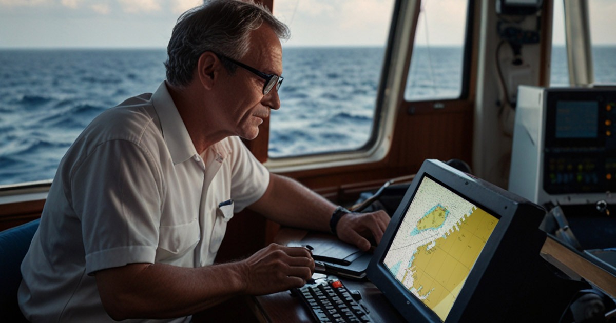
In modern bridge watchkeeping, mastering the Electronic Chart Display and Information System (ECDIS) is no longer optional- it’s mandatory.
As an IMO-compliant digital replacement for paper charts, ECDIS empowers deck officers with real-time navigation, integrated data, and enhanced decision-making tools.
But to use ECDIS effectively and legally, every Officer of the Watch (OOW) must undergo proper training and familiarization, as required by SOLAS Chapter V and the STCW Convention (A-II/1 & A-II/2).
This guide explains both basic and advanced ECDIS functions, helping deck officers operate the system confidently and safely under all navigational circumstances.
📡 What is ECDIS?
ECDIS stands for Electronic Chart Display and Information System– a computerized navigation system designed to comply with IMO performance standards.
It displays Electronic Navigational Charts (ENCs) and integrates data from multiple onboard sensors to provide accurate, real-time vessel positioning.
🛠️ Core Features of ECDIS:
- Displays official ENCs from authorized Hydrographic Offices
- Interfaces with other bridge equipment, such as:
- AIS (Automatic Identification System)
- RADAR
- GPS
- Echo Sounder
- Gyro Compass
- Speed and Distance Log
- Rudder Angle Indicator
- Visualizes the ship’s live movement, surrounding traffic, and navigational hazards
- Complies with IMO and SOLAS regulations on mandatory carriage
🚢 Benefits of Using ECDIS:
✅ Enhanced situational awareness
✅ Real-time vessel tracking
✅ Fewer human errors in chart corrections
✅ Route optimization and safety contours
✅ Legal compliance with global maritime rules
🧰 Basic Functions of ECDIS Every Officer Should Know
Regardless of the ECDIS model (e.g., JRC, Furuno, Transas, etc.), the following basic functions are standardized across all IMO-approved systems:
1. 📍 Navigation Tools (Bearings and Ranges)
Officers must know how to:
- Plot bearings and ranges from terrestrial objects
- Use radar overlay to verify the position of beacons, buoys, or landmasses
- Cross-check GPS input with chart data for position accuracy
2. 🚨 ECDIS Alarms and Warnings
ECDIS will issue alarms when:
- The chart in use is not an official ENC
- There’s a GPS-to-ECDIS datum mismatch
- Navigational hazards or safety contours are breached
Knowing how to interpret, acknowledge, and respond to alarms is vital for watchkeeping.
3. 🗺️ Electronic Chart Symbols
ECDIS chart symbols follow IHO S-52 standards. Officers must:
- Recognize key hazard indicators like the “Generic Hazard” ⚠️ symbol
- Access object info to identify dangers (wrecks, rocks, cables, etc.)
4. 📊 Status and System Information
ECDIS displays critical system status indicators:
- Chart Validity – Are charts updated and official?
- GPS Reception – Signal status and satellite coverage
- Alarm Activity – Active, acknowledged, or suppressed warnings
- Layer Settings – Visibility of navigational layers and data
Tip: Be aware of suppressed layers, especially when filtering chart information. Critical hazards might be hidden.
5. 🔄 Resetting Layers and Display Settings
Officers must:
- Reset ECDIS layers to “standard display” when taking over the watch
- Ensure that safety contours, depths, hazards, and route info are visible
- Avoid using “base display” during navigation as it omits essential objects
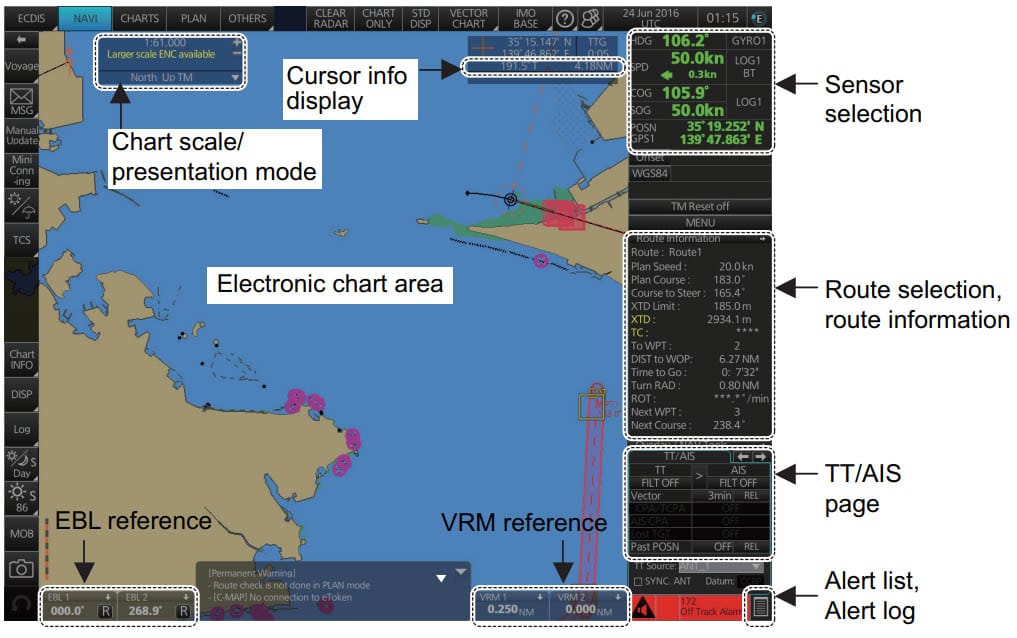
6. 🖥️ ECDIS Interface Layout and Connections
Every officer should be able to:
- Understand the ECDIS menu structure and screen zones
- Identify system connections (GPS, AIS, Gyro, Power Supply, etc.)
- Troubleshoot minor issues like:
- Frozen screen
- Missing GPS input
- Lag in position updates
Tip: Familiarize yourself with the model-specific ECDIS User Manual and onboard circuit diagrams.
🧠 Advanced ECDIS Functions Every Officer Should Master
Beyond basic features, ECDIS offers powerful advanced functions that enable safer route planning, better monitoring, and enhanced situational awareness.
These features are especially useful during coastal navigation, pilotage, and restricted waters.
7. 🛣️ Route Monitoring Functions
ECDIS continuously monitors the ship’s progress along the planned route. Key parameters include:
- Safety Contour – Sets a depth boundary that triggers alarms if crossed
- Safety Depth – Highlights depths shallower than the set value
- Cross Track Distance (XTD) – Monitors deviation from the intended track
- Look-Ahead Zones – Detects hazards ahead of the vessel’s path
🧭 These safety settings help prevent grounding and alert the OOW to navigational dangers in real time.
8. ⚙️ Custom Display and Alarm Settings
ECDIS allows officers to personalize some settings for user preference or operational needs, but certain non-negotiables must remain untouched:
🚫 Avoid:
- Changing the chart datum (Always use WGS84)
- Suppressing hazard indicators
- Overriding Master-set alarms
✅ Maintain:
- Visibility of wrecks, isolated dangers, obstructions, and restricted areas
- Activation of safety alarms, even when customizing layout
Proper use of customization improves usability- improper use risks safety and compliance.
9. 🗺️ Route Planning Tools
ECDIS supports route creation, validation, and optimization through:
- Waypoint plotting with speed and leg info
- Route validation against charted dangers
- Checking for ENC gaps or missing data
- Tidal info, no-go areas, and traffic separation schemes
🛑 Before activating a route, officers must always:
- Save and back up the route securely
- Cross-check it with paper charts (if still in use)
- Validate waypoints with Master’s Standing Orders
🎓 ECDIS Training and Familiarization (STCW & Company)
According to the STCW Code (Section A-II/1 and A-II/2) and IMO Model Course 1.27, all navigational officers must complete:
- ✅ Generic ECDIS Training
- Covers the theory, functions, and IMO standards
- Required before serving as OOW on an ECDIS-equipped ship
- ✅ Type-Specific Training
- Covers the exact model used onboard (e.g., Furuno, JRC, Transas)
- Usually provided during crew change or vessel joining
- ✅ Onboard Familiarization
- Includes company checklists, alarm settings, reset procedures, etc.
- Must be completed before assuming the bridge watch
📋 Officers should regularly:
- Practice in open waters
- Review the User Manual and ECDIS quick-reference cards
- Stay updated on software revisions and interface changes
❓ Frequently Asked Questions (FAQ)
🔹 What is the difference between ENC and RNC in ECDIS?
- ENC (Electronic Navigational Chart): Official vector charts used for legal navigation.
- RNC (Raster Navigational Chart): Scanned images of paper charts; used only in fallback or dual-fitted ECDIS.
🔹 Is ECDIS mandatory on all ships?
- Not all. SOLAS Chapter V mandates ECDIS on:
- Passenger ships ≥ 500 GT
- Tankers ≥ 3,000 GT
- Cargo ships ≥ 10,000 GT
(Deadlines vary by vessel type and construction date.)
🔹 Can I operate ECDIS without training?
- No. Both generic and type-specific training are mandatory under STCW and ISM Code. Unauthorized use can lead to detention during port inspections.
📢 Conclusion: Mastering ECDIS is a Non-Negotiable Skill
For today’s deck officers, ECDIS proficiency isn’t a bonus- it’s a requirement.
Whether navigating in open oceans or confined waters, your ability to use both the basic and advanced functions of ECDIS directly affects your vessel’s safety, compliance, and efficiency.
✅ Get trained.
✅ Stay familiar.
✅ Practice often.
May the winds be in your favor
Leave a Reply