



Celestial Navigation, also known as astronavigation, is the time-honored art and science of determining a vessel’s position on Earth by observing the sun, moon, planets, and stars.
It is a foundational maritime skill, independent of any electronic systems.
🚀 Key Takeaways:
- Celestial navigation uses celestial bodies to find a ship’s geographic position.
- The core principle involves measuring a body’s altitude to calculate a Line of Position (LOP).
- A position fix is obtained by crossing two or more LOPs.
- Essential tools include a marine sextant, a chronometer, and the Nautical Almanac.
- It remains a critical backup system to GPS and ECDIS.
🌍 What Is Celestial Navigation?
Celestial navigation is the art and science of determining your position on Earth by observing the positions of celestial bodies- such as the sun, moon, stars, and planets– in relation to the horizon.
When modern navigational systems fail, celestial navigation (CelNav) becomes a seafarer’s fallback skill, allowing you to calculate your ship’s location using time, angles, and astronomical references.
This method is also called astronavigation, and the terms are used interchangeably across maritime training.
💡 Why Learn Celestial Navigation?
Many cadets and young officers feel overwhelmed by celestial navigation, and that’s understandable.
Compared to ECDIS or GPS, it seems more abstract and math-heavy.
But here’s why every professional mariner should still learn CelNav:
🔌 1. Electronic Navigation Has Limits
Modern systems like GPS, ECDIS, AIS, and radar depend on electricity and external signals.
If these fail, and they can, you’ll need a manual backup to fix your ship’s position.
🧠 2. It’s a Timeless Skill
Knowing how to navigate using the stars is a lifelong skill that requires no internet, no signals, and no batteries.
It’s just you, your tools, and the sky.
🌌 3. Builds Respect for the Craft
Understanding celestial navigation gives you insight into how early seafarers explored the unknown with nothing but the night sky as their guide.
💬 4. Surprising Conversations Starter
Believe it or not, knowing the constellations and how to use them can make for a great story, especially when you explain it to someone curious (maybe even your crush 😉).

🧭 Core Principles and Key Elements of Celestial Navigation
Mastering celestial navigation means understanding its foundational concepts and tools. Here are the core elements every seafarer should know:
🌠 1. Celestial Bodies
These are the astronomical objects used in navigation:
- Sun
- Moon
- Stars (e.g., Polaris, Sirius, Altair)
- Planets (e.g., Venus, Jupiter, Mars)
Navigators measure the altitude (angle above the horizon) of these bodies to determine a Line of Position (LOP), which helps fix the ship’s location.
🌐 2. Celestial Sphere
The celestial sphere is an imaginary globe surrounding the Earth, onto which all celestial bodies are projected.
It helps us visualize and calculate the positions of stars and planets.
Just like we use latitude and longitude on Earth, the celestial sphere uses:
| Earth Coordinate | Celestial Sphere Equivalent |
| Equator | Celestial Equator |
| Prime Meridian | Celestial Greenwich |
| Latitude | Declination |
| Longitude | Right Ascension (RA) / Hour Angle |
| North/South Pole | North/South Celestial Pole |
The position of a celestial body on the celestial sphere directly corresponds to a Geographical Position (GP) on the Earth’s surface- the point where the body is directly overhead.

🧰 3. Marine Sextant
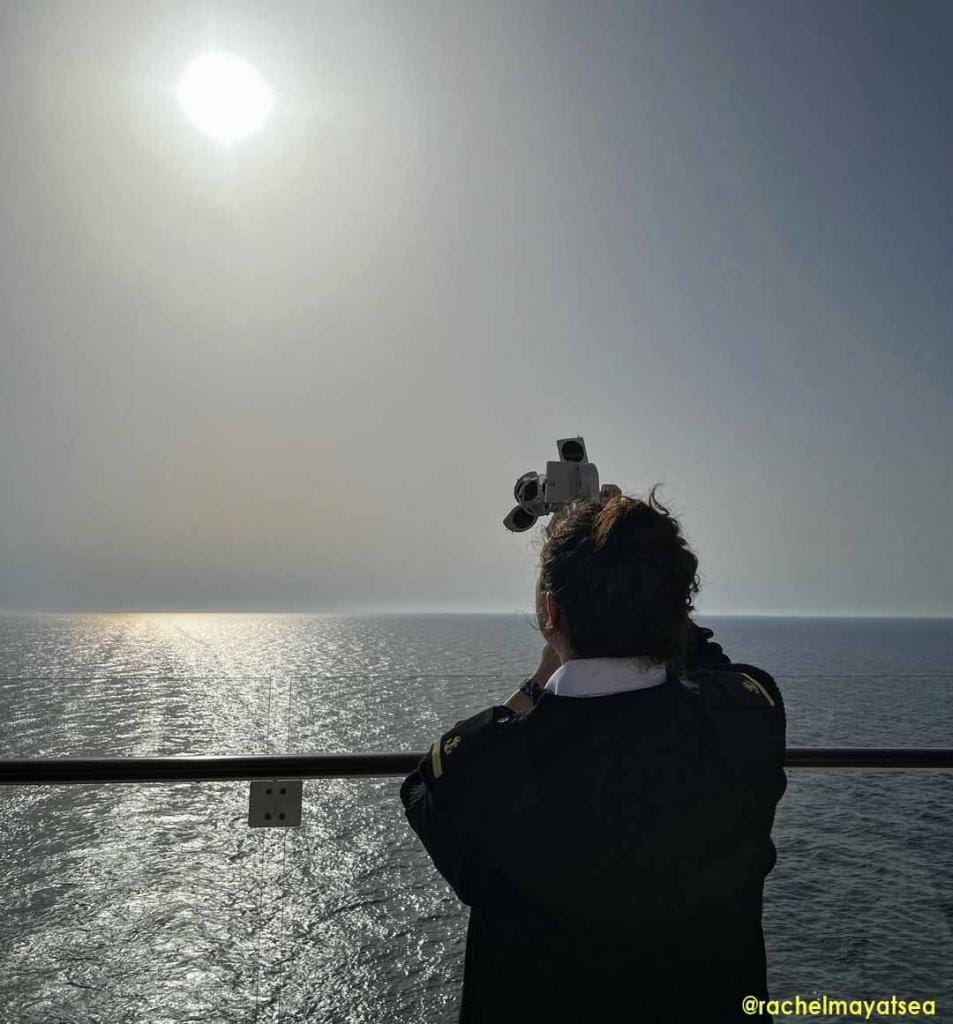
The marine sextant is the primary instrument used to measure the altitude of a celestial body above the visible horizon.
- It helps determine the angle between the horizon and the observed object.
- Sextant readings are corrected and referenced against the nautical almanac to compute an LOP.
Accurate sextant work is a vital part of any celestial fix.
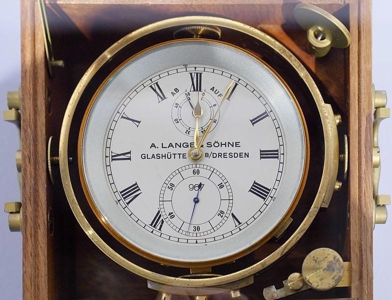
🕒 4. Timekeeping with a Marine Chronometer
Precise time is essential for celestial navigation. Even a 4-minute error can result in a 1° error in longitude- roughly 60 nautical miles!
The marine chronometer is a high-precision timepiece set to Greenwich Mean Time (GMT). It’s used to:
- Compute Greenwich Hour Angle (GHA)
- Synchronize sights
- Maintain accurate records during observations
🌊 5. The Visible Horizon
The horizon is the apparent line where the sea meets the sky. It acts as your base level for measuring celestial altitudes.
- A clear, unobstructed horizon (common at sea) improves sight accuracy.
- Sextants use the horizon to align the celestial body for measurement.
📖 6. Nautical Almanac
The nautical almanac is your go-to book for celestial navigation.
It contains precomputed astronomical data about the positions of celestial bodies at different times of the day, every day of the year.
It provides:
- Greenwich Hour Angle (GHA)
- Declination
- Sidereal Hour Angle (SHA)
- Times of sunrise, sunset, moonrise, and twilight
- Eclipses and planetary data
These values are used to calculate the assumed position of the observer and compare it against the measured altitude of the celestial object.
⛵ Pro Tip: Always cross-check your almanac’s year. Outdated data = faulty fixes!
📘 7. Sight Reduction Tables
Sight reduction tables simplify the trigonometric calculations needed in celestial fixes.
The most common reference onboard is:
- 📗 Norie’s Nautical Tables, especially Volume 2: HO 249 or HO 229.
These tables help:
- Convert the observed altitude to a calculated altitude (Hc)
- Find azimuth angles
- Determine the intercept (difference between observed and calculated altitudes)
💡 Result: You get your Line of Position (LOP), which you’ll later plot on a nautical chart.
📍 8. Dead Reckoning (DR)
Dead reckoning is the estimation of your current position based on:
- Last known position
- Course steered
- Speed made good
- Time elapsed
While less accurate than celestial or GPS fixes, DR is crucial as a baseline when combining with celestial sights.
⚓ Use your DR position to plan your sight, especially when choosing your assumed position for sight reduction.
📊 9. Plotting Your Celestial Fix
Once you have your LOP(s) from one or more celestial bodies, you’ll plot them on the chart to get your fix.
Here’s the process:
- Plot the assumed position (AP) based on DR
- Determine the azimuth of the celestial body
- Use the intercept to draw your LOP (towards or away from the GP)
- Repeat with another celestial body (ideally at least 60° apart)
- Fix your position at the intersection of two or more LOPs
🧭 You’ve now obtained a celestial fix, a plotted position using just your tools and the sky.
⚙️ How Celestial Navigation Works (Step-by-Step)
To simplify, here’s a practical breakdown of how you use celestial navigation onboard:
📝 1. Plan Your Sight
Choose which celestial body to observe and when. Preferably, take a morning, noon, and evening sight.
⏱ 2. Time the Observation Accurately
Use a marine chronometer to log the exact time in GMT. Even a few seconds off affects your fix.
🎯 3. Measure Altitude with Sextant
Take a sight of the celestial body above the horizon. Use index error correction and dip correction if needed.
📖 4. Use Nautical Almanac + Sight Reduction Tables
Refer to the almanac for GHA and declination. Use HO 249 or Norie’s Tables to determine the Hc, azimuth, and intercept.
🗺 5. Plot LOP and Get Fix
Draw your LOP on the chart. Combine it with your DR track and other sights to determine your ship’s position.
📚 Bonus: Essential Tools for Celestial Navigation
| Tool | Purpose |
| Sextant | Measures celestial altitude |
| Marine Chronometer | Tracks GMT time accurately |
| Nautical Almanac | Provides GHA, declination, etc. |
| Sight Reduction Tables | Helps compute azimuth and intercept |
| Plotting Sheets / Nautical Chart | For marking LOPs and fixes |
| Dividers & Parallel Ruler | Navigation plotting tools |
| Calculator / Workform | For math and recordkeeping |
❓ FAQ: Celestial Navigation Basics
Q1: Is celestial navigation still taught today?
🧭 Yes. It’s part of maritime education worldwide and required for STCW-compliant deck officers.
Q2: Do modern ships still use it?
🛰️ It’s used as a backup navigation method, especially in GPS-denied environments or when electronic systems fail.
Q3: How accurate is it?
With correct procedures, celestial navigation can yield an accuracy of 1-2 nautical miles, enough for safe ocean passage.
Q4: What is a Line of Position (LOP)?
An LOP is a line drawn on a chart that shows where you could be based on a celestial sight. Two or more LOPs give a fix.
Q5: What’s the best time to take sights?
Typically morning twilight, local noon, and evening twilight– when celestial bodies are most visible.
🧭 Final Thoughts: Why It Still Matters
Celestial navigation may feel outdated, but its relevance endures. Every competent mariner should know how to navigate without relying solely on electronics.
It teaches you:
- Precision and discipline
- Respect for traditional seamanship
- A deeper understanding of the skies, Earth, and sea
Even with satellite tech onboard, the ability to fix your position using only the heavens and a few tools is the hallmark of a true navigator.
Want to master celestial navigation?
- 👉 Bookmark this guide and share it with your fellow cadets and officers.
- 📘 Practice taking sun sights and challenge yourself to plot a noon-sight for latitude.
May the winds be in your favor.
Leave a Reply