


Marine navigation has come a long way- from ancient mariners steering by the stars to today’s GPS-driven bridge systems.
But despite the rise of sophisticated electronics, the fundamentals of navigation remain the same.
Whether you’re commanding a fishing boat or a huge oil tanker, understanding the different types of marine navigation is essential to safety, efficiency, and seamanship.
This guide explains the main navigation methods used at sea, both traditional and modern, and when each technique is most effective.
🌊 What Is Marine Navigation?
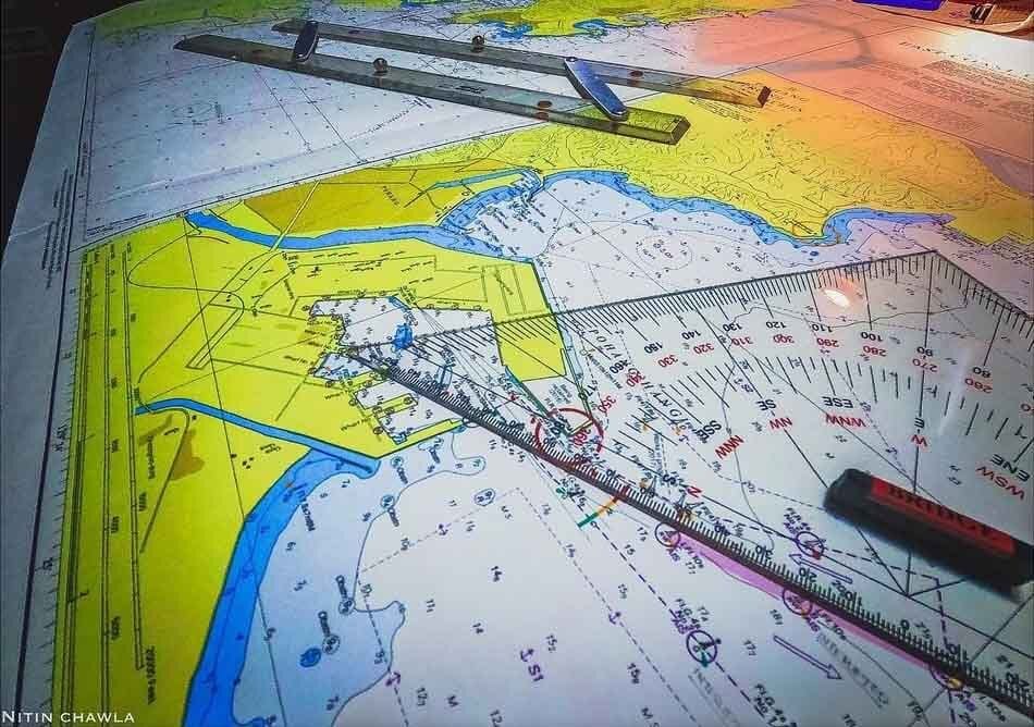
Marine navigation is the science and art of directing a vessel safely from one point to another, following the shortest, safest, and most convenient route.
This involves:
- Determining the ship’s position (position fixing)
- Plotting and adjusting the course
- Using instruments, reference points, and technology to avoid hazards
The bridge team, led by the captain, must harmonize all navigational methods available to maintain safety, especially in congested, coastal, or unfamiliar waters.
⚓ Traditional Marine Navigation Methods
Before the age of satellites, mariners used land features, the sun, and mathematical estimates to find their way across the oceans.
These traditional techniques are still taught and used today often as fallbacks in case modern systems fail.
🗺️ Terrestrial Navigation
What Is Terrestrial Navigation?
Derived from the Latin word terra (land), terrestrial navigation uses visual landmarks and man-made structures on land to fix a vessel’s position.
Typical references include:
- Natural features: mountains, cliffs, river mouths, headlands
- Man-made aids: lighthouses, buoys, bridge pillars, breakwaters
This technique is most useful during coastal navigation, channeling, or pilotage.
How It Works
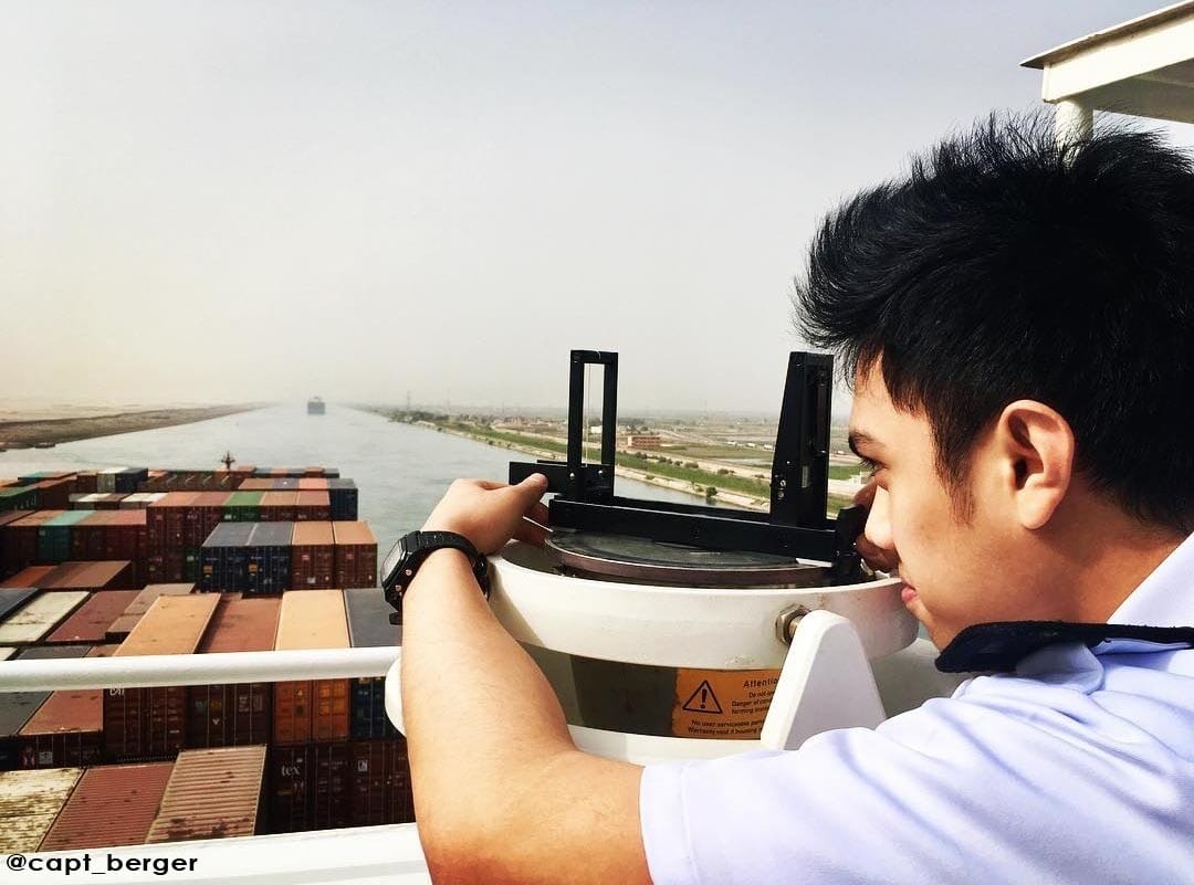
The most common method is cross-bearing, where navigators take bearings of two or more conspicuous objects.
The point where these lines intersect indicates the ship’s position.
This is usually done:
- Visually using a pelorus or bearing compass
- With radar, especially at night or in low visibility
🧭 Example:
If a vessel sights a lighthouse on the port beam and a promontory directly ahead, the navigator may need to alter course to starboard to avoid danger. Earlier or later turns might be dangerous for the vessel.
🌌 Celestial Navigation
What Is Celestial Navigation?
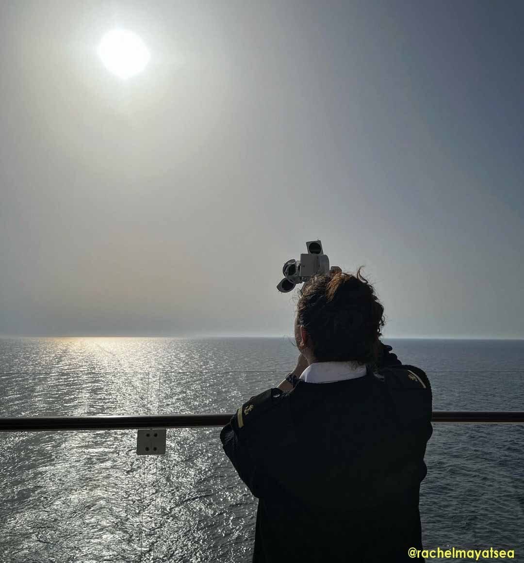
Celestial navigation determines the ship’s position using celestial bodies like the sun, moon, stars, and planets.
It became the standard for oceanic voyages once sailors ventured beyond sight of land.
Navigators use a marine sextant to measure the angle between a celestial body and the horizon. With the help of:
- Nautical almanacs
- Sight reduction tables
- Spherical trigonometry
they plot a line of position (LOP) onto a paper chart.
📌 CelNav was how Magellan reached the Philippines and Columbus discovered the New World long before GPS.
Why It Still Matters
Though often viewed as outdated, celestial navigation is still part of maritime training and serves as a vital backup during GPS outages, solar flares, or electronic failure.
🧮 Dead Reckoning (DR) Navigation
What Is Dead Reckoning?
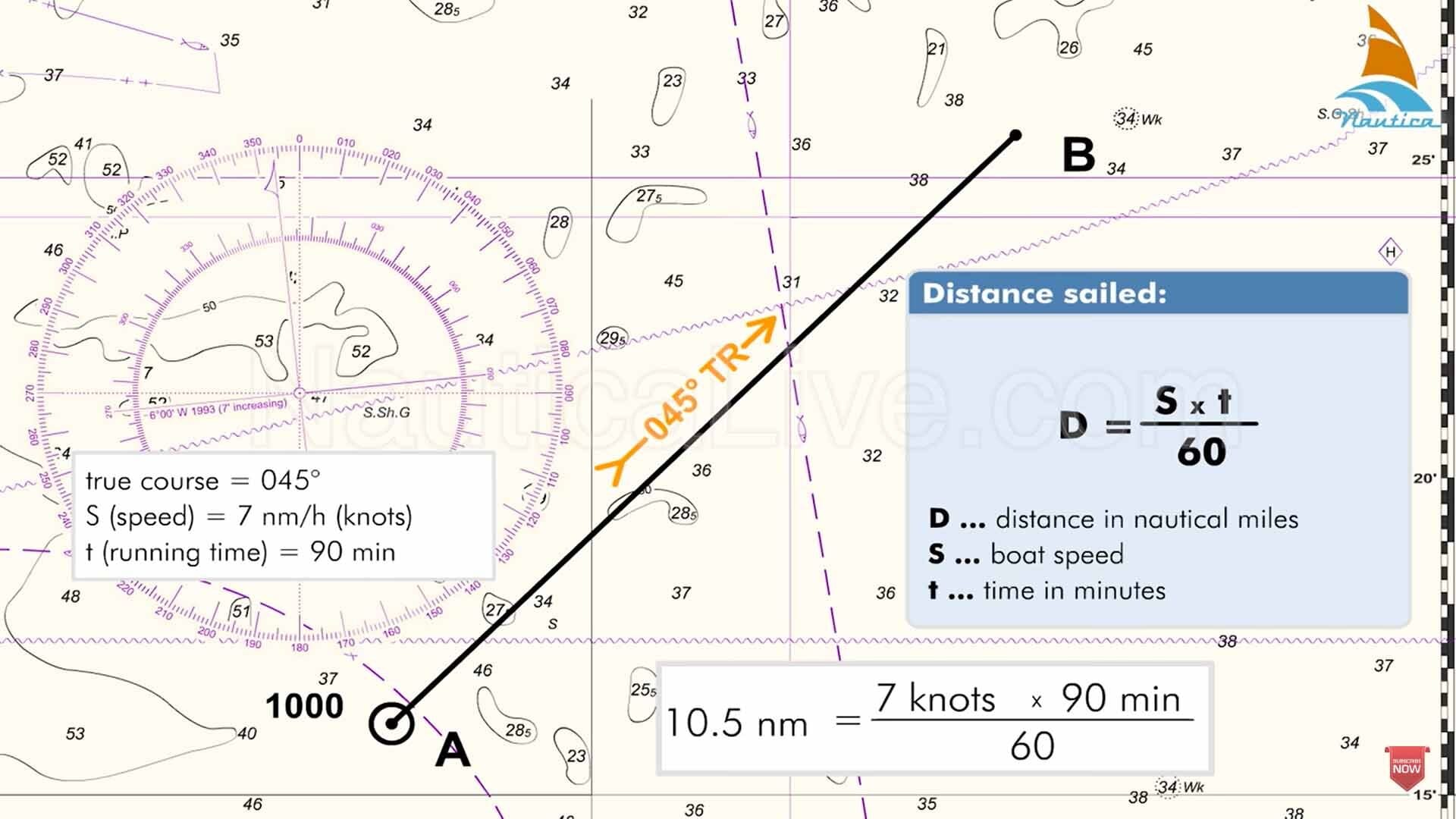
Dead reckoning (DR) estimates the vessel’s current position based on its last known position, course steered, speed, and elapsed time.
It doesn’t rely on external references like stars or land.
DR Formula:
Distance (D) = Speed (S) × Time (T)
New Position = Previous Position + (Course × Distance)
This method is useful when:
- Celestial sights are impossible (cloudy skies)
- GPS is unavailable
- In open ocean passages
If you apply corrections for wind, current, and steering errors, the resulting position becomes an Estimated Position (EP) rather than a pure DR fix.
🧭 Summary of Traditional Methods
| Method | Used When | Tools Required |
| Terrestrial | Coastal / inland waters | Compass, pelorus, radar |
| Celestial | Open ocean | Sextant, almanac, tables |
| Dead Reckoning | No external references | Course log, speed log, time |
🛰️ Modern Marine Navigation Methods
With the invention of radio signals and satellite systems, marine navigation has evolved into a highly accurate, automated discipline.
These electronic tools allow navigators to fix positions within seconds even in the middle of the ocean.
Let’s explore the major types of electronic navigation used onboard today.
⚡ Electronic Navigation
What Is Electronic Navigation?
Electronic navigation refers to any method of determining a vessel’s position using radio time signals, radar reflections, or satellite transmissions.
It often integrates with bridge navigation systems, such as:
- ECDIS (Electronic Chart Display and Information System)
- AIS (Automatic Identification System)
- GPS receivers
- Radar overlays and ENC data
This form of navigation is fast, accurate, and interactive but it relies entirely on electrical systems and connectivity.
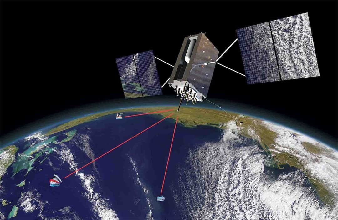
Types of Electronic Navigation
📡 Radio Navigation
Radio navigation determines position using signals from shore-based radio transmitters.
These ground beacons emit waves that the ship’s receivers pick up, allowing them to calculate position through signal timing or triangulation.
✅ Examples of radio navigation systems:
- LORAN (Long Range Navigation)
- Decca Navigator System
- Omega (now obsolete)
⚠️ Note: While mostly outdated, understanding radio nav systems is still essential for licensing exams and as a GPS backup method.
📶 Radar Navigation
Radar navigation uses electromagnetic pulses to detect and track nearby objects.
Reflected signals bounce back from targets like landmasses, ships, or buoys– displaying their position on a radar screen.
Common uses include:
- Collision avoidance
- Position fixing using radar bearings and ranges
- Navigating in low visibility or close-quarter situations
Radar is especially useful in coastal or harbor navigation, where physical objects are abundant.
🌐 Satellite Navigation (GPS)
Satellite navigation, often referred to simply as GPS (Global Positioning System), is the most widely used positioning method onboard commercial ships today.
It works by:
- Receiving signals from geostationary satellites orbiting Earth
- Calculating distances from at least four satellites
- Determining the ship’s latitude, longitude, speed, and course
GPS offers global coverage, making it ideal for deep-sea and transoceanic voyages.
Fun Fact: Modern merchant vessels often carry dual GPS receivers for redundancy and reliability.
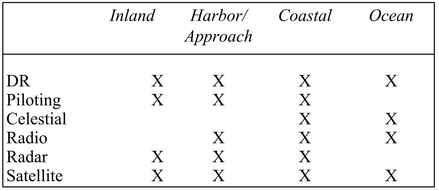
📊 Traditional vs Modern Navigation: A Comparison
| Feature | Traditional Methods | Modern Electronic Methods |
| Accuracy | Moderate | High |
| Reliability | Independent of power | Power-dependent |
| Tools | Sextant, compass, charts | GPS, radar, ECDIS |
| Vulnerability | Weather dependent | Prone to electronic failure |
| Skills required | High manual calculation | System monitoring and input |
Both systems have strengths and weaknesses. This is why maritime training emphasizes using both traditional and modern techniques.
🧠 Why Seamanship Still Matters in the Digital Age
Despite the high-tech equipment available, good seamanship and fundamental navigation skills are irreplaceable.
Electronic systems can malfunction, be spoofed, or lose signal. In such cases, knowing how to:
- Plot a DR position
- Use a sextant or pelorus
- Cross-reference radar with paper charts
…can be the difference between a routine watch and a navigational incident.
This is why many navigators continue practicing celestial sights and DR plotting, even in the age of satellites.
❓ Frequently Asked Questions (Optional FAQ Block for Schema)
What is the most accurate type of marine navigation?
Satellite navigation (GPS) is currently the most accurate method, offering global positioning within a few meters.
Why is celestial navigation still taught?
It’s a reliable backup when GPS fails or is unavailable. It also builds fundamental navigational understanding.
What is the difference between DR and EP?
Dead Reckoning (DR) is a position estimated using only course, speed, and time. When you adjust for wind/current, it becomes an Estimated Position (EP).
Can you navigate a ship without GPS?
Yes. With skills in terrestrial, celestial, and radar navigation, a ship can be safely navigated without GPS.
May the winds be in your favor.


Leave a Reply