


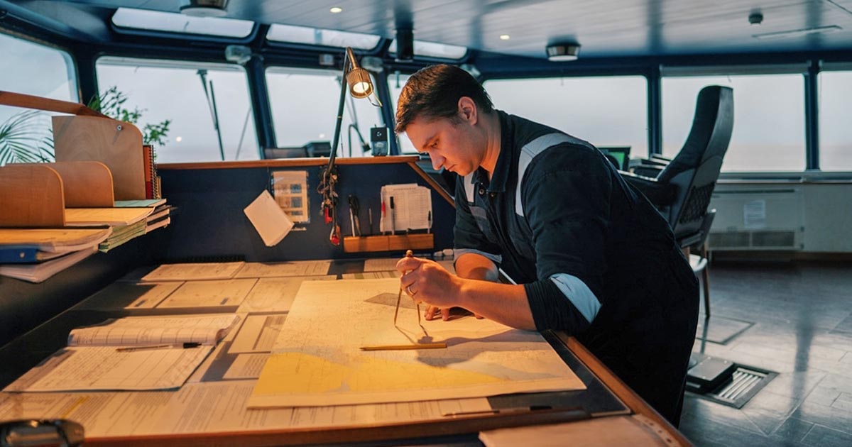
Everything a deck officer must know about passage planning- aligned with SOLAS, STCW, and IMO best practices.
🚢 What Is Voyage Planning? (aka Passage Planning)
Voyage planning, also called passage planning, is a structured process of creating a safe, efficient, and regulation-compliant route for a ship from port of departure to port of arrival.
According to SOLAS Chapter V Regulation 34, STCW A-VIII/2, and IMO Resolution A.893(21), all ships must have a voyage plan before sailing.
This isn’t just “drawing lines on ECDIS.” It’s about using a wide range of data and guidelines to prepare for every leg of the journey.
💡 Goal of Voyage Planning:
Ensure safe navigation, avoid navigational hazards, comply with regulatory requirements, and optimize fuel and time.
⚓ Why Voyage Planning Matters on Board
Your ship’s Second Officer (2/O) often leads this task, coordinating with the Captain (Master) and working overtime to complete the plan before departure.
On modern vessels, this process is primarily done using ECDIS (Electronic Chart Display and Information System) but is still backed by paper charts in many fleets.
A good passage plan can:
- Prevent groundings, collisions, and route deviations
- Optimize bunker consumption
- Ensure compliance with traffic separation schemes, ECAs, and reporting zones
- Prepare for port restrictions, pilotage areas, and emergency contingencies
🧭 Key Factors to Consider in Passage Planning
A complete voyage plan includes a wide array of maritime factors.
Here’s what you must always account for:
| Factor | Description |
| Vessel Specs | Draft, air draft, speed, type, and maneuverability |
| Weather Forecasts | Wind, waves, fog, and storm systems en route |
| Ocean Currents | Impact ETA and course over ground |
| Tidal Info | Critical for under keel clearance at shallow ports |
| Navigational Hazards | Wrecks, rocks, reefs, narrow channels |
| Route Optimization | Shortest safe path to save time and fuel |
| Waypoint Planning | Precise waypoints for monitoring and reporting |
| Regulatory Compliance | SOLAS, MARPOL, load lines, traffic schemes |
| Port Details | Pilot boarding points, VTS zones, port limits |
👉 Pro Tip: Always verify port names and locations. Some ports share names but are located in different countries.

🧠 The 4 Stages of Voyage Planning (APEM)
The IMO divides voyage planning into four sequential stages, abbreviated as APEM:
1️⃣ Appraisal
Gather and analyze all relevant information about the voyage:
- Charts (ENCs and paper)
- Tides and currents
- Weather forecast
- Sailing directions
- Notices to Mariners
- Company SMS requirements
This stage forms the foundation of the plan.
2️⃣ Planning
Develop a comprehensive route using all data from appraisal:
- Mark waypoints
- Consider ECA limits, fuel switchovers
- Comply with regulations and avoid hazards
- Calculate distances and ETAs
📌 Master Review:
The Captain will review and approve (or amend) the plan before execution.
3️⃣ Execution
Put the plan into action:
- Monitor vessel’s performance and environmental conditions
- Adjust as needed, especially for weather changes or traffic
Bridge officers must coordinate and follow the approved route unless an emergency requires deviation.
4️⃣ Monitoring
The voyage is continuously monitored:
- Position checks using GPS, radar, or celestial nav
- Verify each waypoint is met
- Record deviations and corrective actions
⚠️ Important: Monitoring ensures the vessel stays on course and adapts to dynamic conditions.
🧾 SOLAS and IMO References for APEM:
- SOLAS V/34 – Requires a voyage plan before departure
- STCW A-VIII/2 – Watchkeeping procedures
- IMO A.893(21) – Full guideline for voyage planning stages

📋 Step-by-Step Guidelines for Preparing a Voyage Plan
Preparing a passage plan can feel overwhelming, especially when under time pressure.
But by following a logical workflow, you can build a compliant and optimized plan efficiently.
Here are 10 practical steps used by Second Officers onboard modern merchant ships:
✅ 1. Locate the Exact Port
- Confirm the port name and country.
- Use voyage orders or BP Port to Port Guide to find exact coordinates.
- Prevent confusion between ports with the same name (e.g., Port Victoria in Seychelles vs. Canada).
✅ 2. Identify the Pilot Boarding Station
- After confirming the port, locate the pilot boarding area.
- This info is used for calculating distances and setting the first and last waypoints.
✅ 3. Calculate the Total Distance
- Use route planning tools or BP Distance Tables.
- Share the distance with the Master and Chief Engineer for:
- Bunker calculations
- ETA planning
✅ 4. Confirm Departure Draft
- Coordinate with the Chief Officer for the vessel’s departure draft.
- This data is required for:
- Underkeel clearance calculations
- Port restrictions and bridge clearances
✅ 5. Create Initial Waypoints (Overview Scale)
- Start on small scale ENC charts to build your preliminary route.
- Avoid navigational dangers, TSS zones, restricted areas.
✅ 6. Request Updated Charts and Permits
- Retrieve all necessary ENCs or paper charts.
- Ensure they’re updated to the latest Notices to Mariners or ENC permits.
✅ 7. Load Charts & Review Route
- Load charts into ECDIS or verify paper charts.
- Cross-check your initial plan and refine the waypoints.
✅ 8. Build the Detailed Route (Large Scale Charts)
- Using larger scale charts, refine your waypoints.
- Add parallel indexing, safety contours, no-go areas, and ECA boundaries.
✅ 9. Mark All Navigational Details
Include the following on your charts or ECDIS plan:
- 🟨 Pilot boarding points
- 🟦 Reporting areas (VTS, GIBREP, AMVER)
- 🔴 ECA boundaries and fuel switchover zones
- 🟩 Parallel indexing lines
- ⚠️ Dangerous wrecks, shallow patches, traffic lanes
Ensure all markings comply with your Company SMS and Bridge Procedures Manual.
✅ 10. Fill Out the Voyage Planning Form
This is the printed or digital summary of your plan. It typically includes:
- Vessel name, voyage number, draft, and displacement
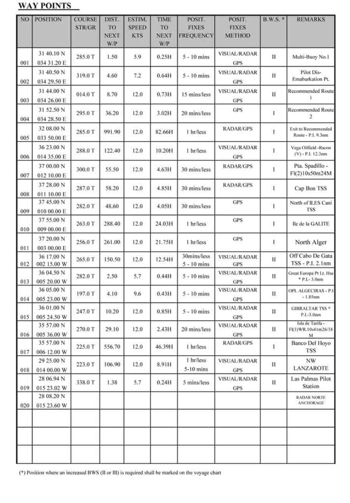
- List of waypoints with positions and courses
- Distances between waypoints
- Reporting areas and compliance notes
- Charts and publications used
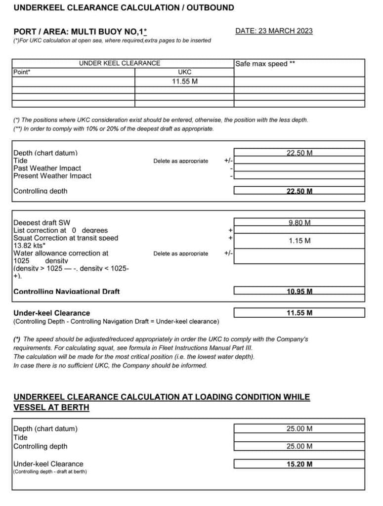
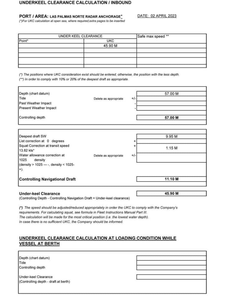
- Underkeel clearance calculations
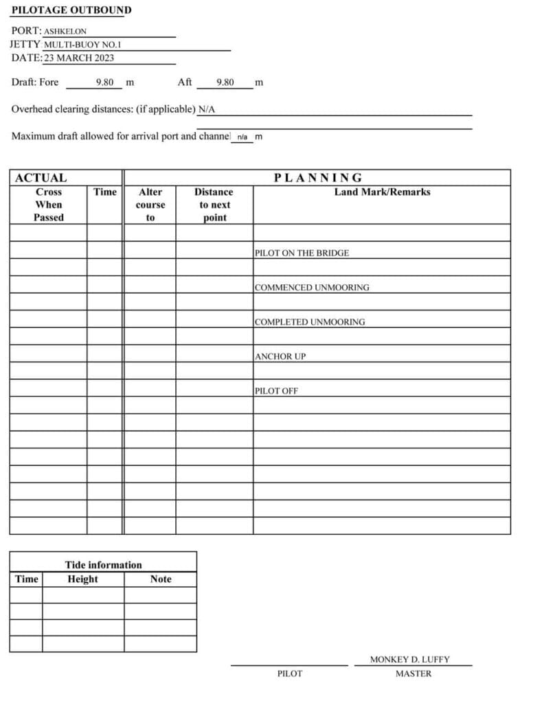
- Pilotage details
📝 Some companies require a 2-page form, while others use up to 20 pages, depending on policy and route complexity.

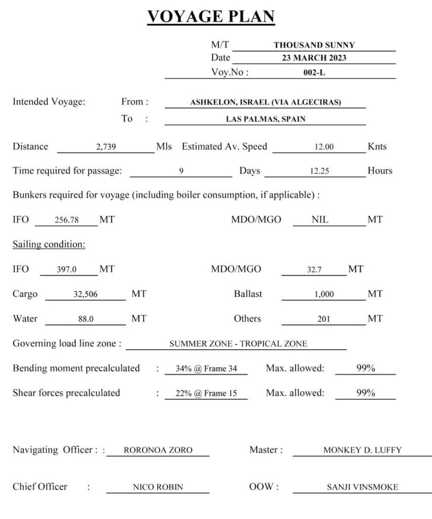
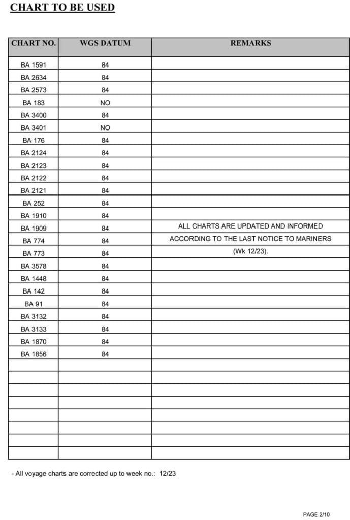
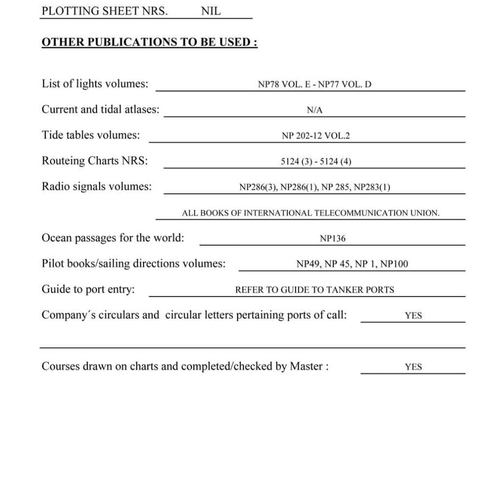
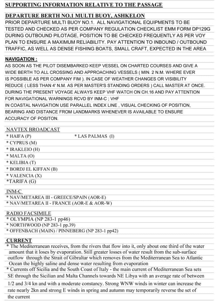
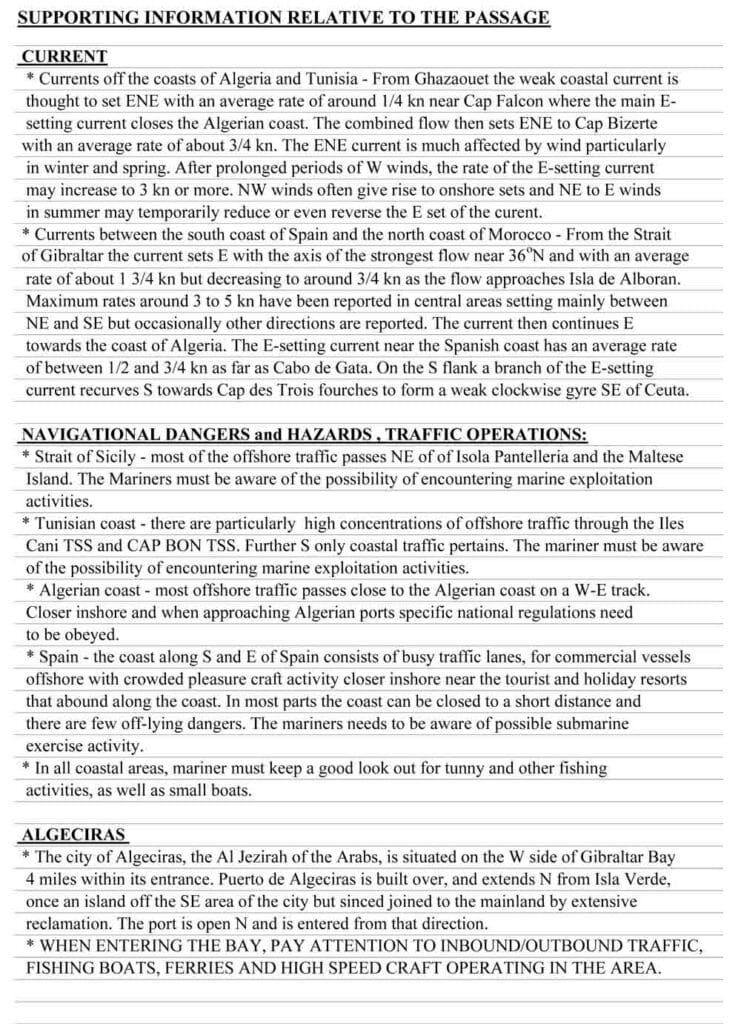
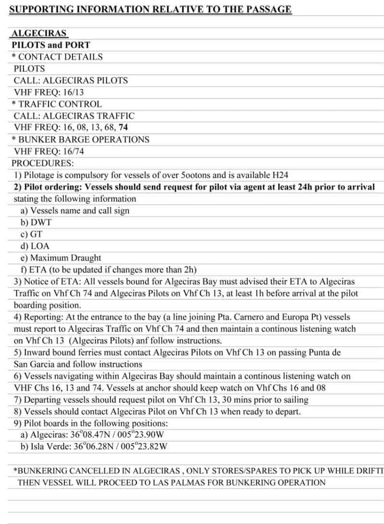
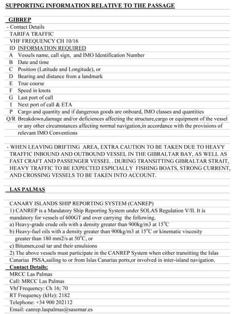
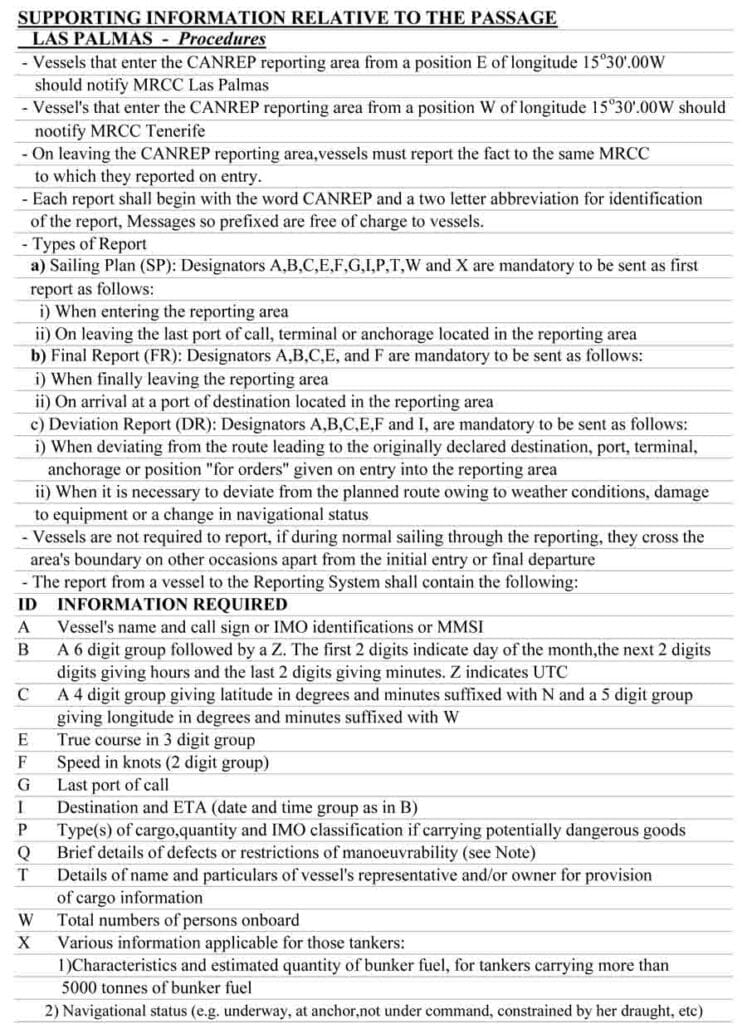
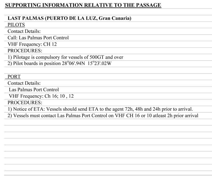
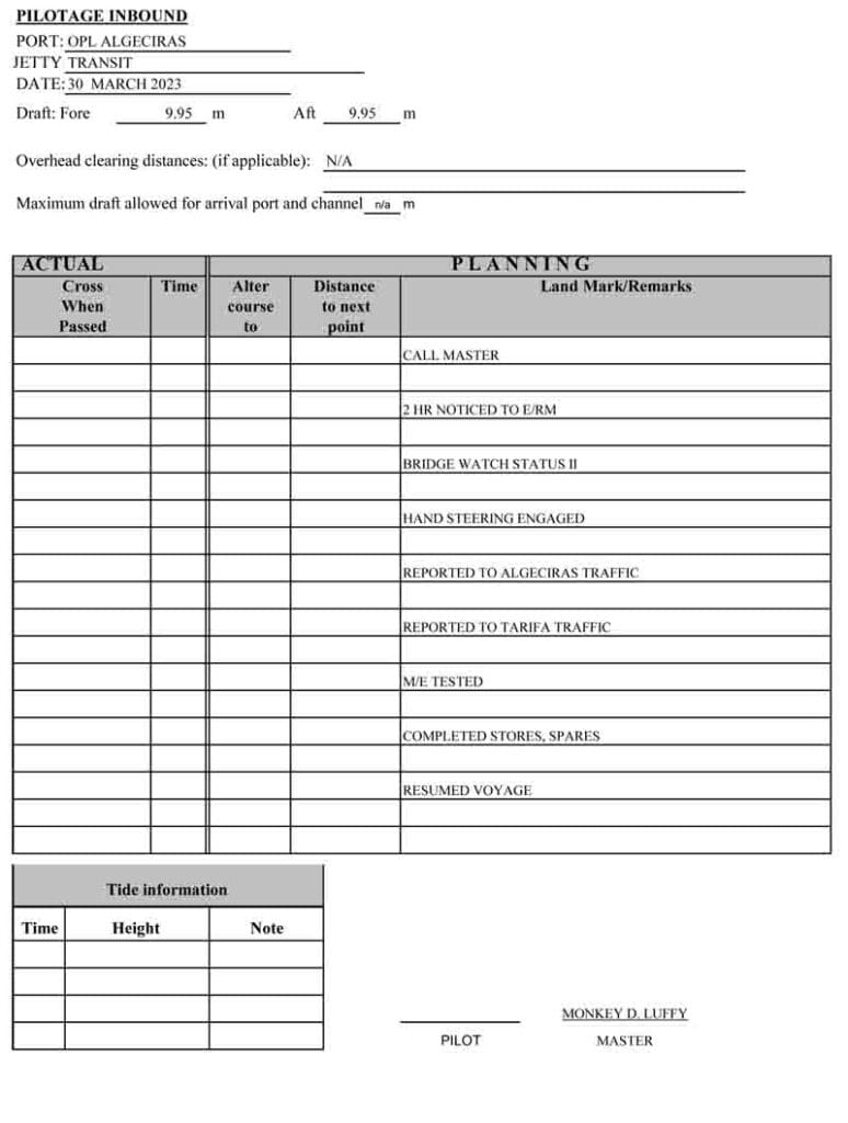
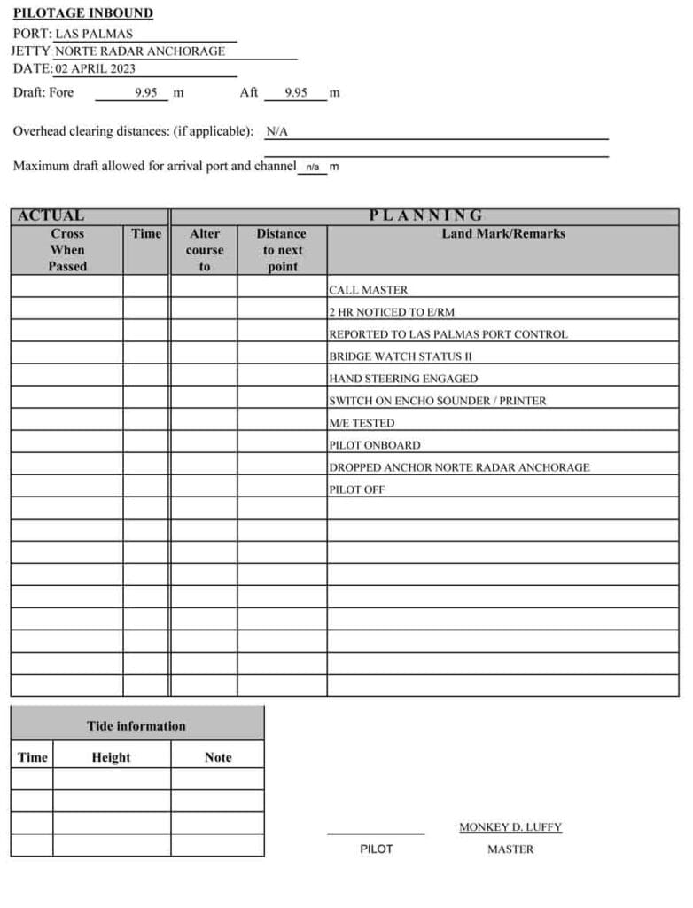
📁 Sample Voyage Plan Example (Ashkelon ➡️ Las Palmas)
Here’s a real-world breakdown of what’s included in a comprehensive voyage plan:
| Page | Description |
| 1 | General voyage info (departure, arrival, draft) |
| 2 | List of charts used |
| 3 | Publications and references |
| 4 | Pilotage Outbound (Ashkelon) |
| 5 | UKC Calculations |
| 6 | Waypoints and route details |
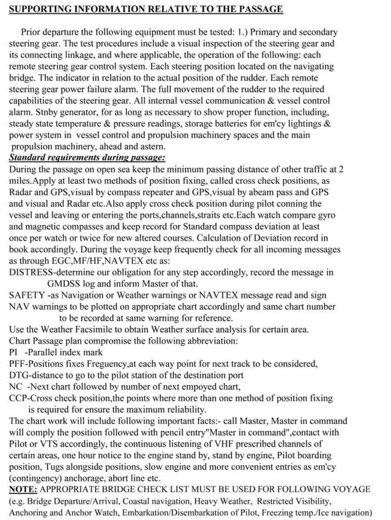
| 7 – 12 | Supporting information: currents, hazards, reporting areas |
| 13 – 15 | Contact details and inbound pilotage |
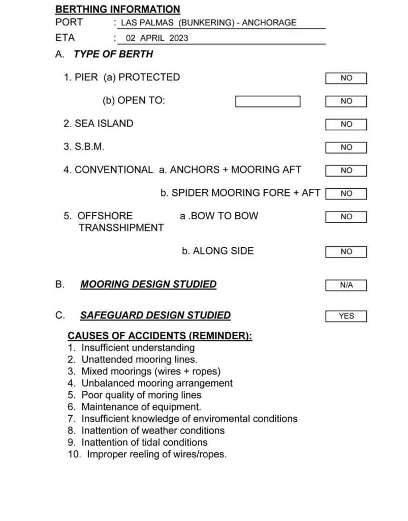
| 16 – 17 | Inbound UKC & berthing info for Las Palmas |
📌 ECDIS Route + Paper Form = Final Plan
Your passage plan is only complete when both the ECDIS routing and Voyage Planning Form are ready, reviewed, and signed by the Master.
“A route in ECDIS is a visual plan. The Voyage Planning Form is its black-and-white legal counterpart.”
⚠️ Final Reminders for Officers in Charge
- Always involve the Master early for planning direction.
- Double-check charts and regulations, especially near sensitive areas (e.g., straits, ECAs).
- Keep alternative plans ready for weather reroutes or emergency anchorage.
- Document all deviations during execution for post-voyage reporting.
🧭 Conclusion: The Seafarer’s Role in Safe Navigation
Voyage planning isn’t just about ticking off company procedures- it’s about keeping your vessel, cargo, and crew safe, compliant, and efficient.
From APEM stages to detailed waypoint markings, your plan sets the tone for a successful passage.
May the winds be in your favor.


Leave a Reply